We’re excited to share our maps and insights on Nigeria’s flood vulnerability, highlighting drainage patterns, hydrological zones, digital elevation, and high-risk flood areas. By understanding these factors, we can build better resilience and response strategies for our communities.
Explore the data, take action, and let’s work together for a sustainable future.
Map Features
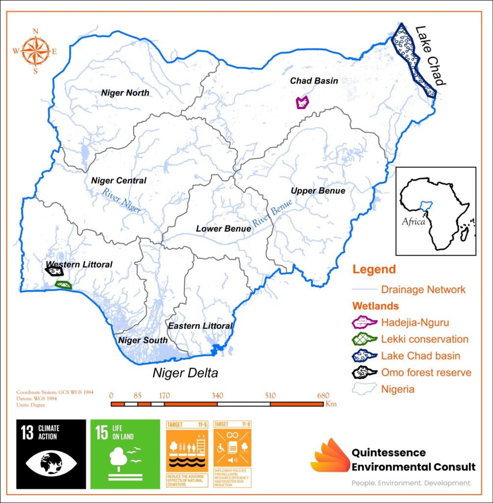
Drainage Pattern
Primary drainage pathways, various wetlands.
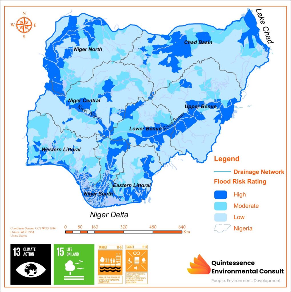
It drains via the river Niger and river Benue towards Niger Delta region which is the primary outlet to the Atlantic Ocean.
Lagos has a dendritic drainage pattern and high rainfall, facing significant flood risks.
Wetlands
The wetlands in Nigeria cover approximately 13 million hectares, constituting a significant portion of our landscape.
These sustains an exceptional level of biodiversity by providing vital habitats for a wide range of plant species, diverse bird populations, and numerous aquatic animals.
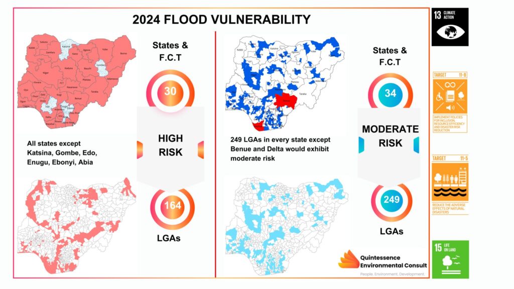
Most susceptible regions to flooding
Niger North and Central, Upper and Lower Benue, Niger South, lower fringes of western littoral, part of Cross River, Sokoto-Rima, and Komadougu-Yobe.
Niger Delta region is highly susceptible to flooding due to its low elevation and poor drainage.