
Carbon Stock Assessment
Precision forest monitoring for carbon sequestration projects. Leverage satellite data, AI, and field insights for accurate carbon stock assessments.
Enhance transparency, reporting, and climate finance eligibility.
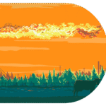
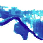
Methane Emission Tracking
Wetland health mapping to curb greenhouse gases.
Track methane emissions, land cover changes, and hydrological shifts in real time.
Inform restoration efforts and climate mitigation strategies with data-driven precision.
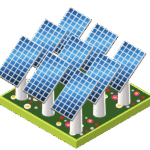 Renewable Energy
Site suitability analysis for solar and wind farm projects.
Integrate geospatial data, climate patterns, and land use to identify optimal locations.
Maximize energy yield while minimizing environmental and social impacts.
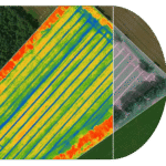
Precision Agriculture
Crop health insights to combat climate variability. Utilize remote sensing and machine learning to detect stress early and boost resilience.
Support adaptive farming decisions and secure food systems in a changing climate.
 Urban Heat Mapping
Green infrastructure planning for cooler cities.
Design urban spaces with trees, parks, and permeable surfaces to reduce heat islands.
Improve public health, enhance livability, and build climate-resilient communities.
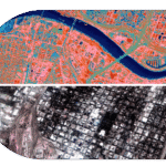
 Disaster Risk Management
Flood risk assessment & rapid post-disaster response.
Use predictive modeling and satellite imagery for early warnings and damage mapping.
Support emergency planning, infrastructure resilience, and faster community recovery.